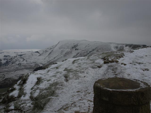
Tuesday dawned with nice weather, and our first day off for - Oooooo - THREE DAYS ;-) We'd just got back from ten days in Gran Canaria, so to go from this;
To walking in snow was a bit of a shock to the system! However, we'd not done any 'serious' walking for two or three weeks, so Sue suggested a pull up onto Kinder Scout. This meant a climb of almost 2,000 feet, even on a nice day like today, at this time of the year, Kinder could be very 'UN-Kind-er', weather and temperature-wise. Although it was set fair all day, we took no chances and wore warm clothes. This stunning view of the Winnats pass greeted us as we made our way to the Edale valley. Not long ago, we were on the top of those cliffs in deep snow, today they looked a very different picture, benign in the sunshine.
A glance to the right saw the face of the 'shivering mountain' - Mam Tor.
Soon we arrived at Barber Booth, where there is limited free parking - some of the very little available now in the peak District. We left the car around mid-day, with clear skies and the prospect of a good walk ahead of us. This is Horsehill Tor and the walk to Edale to begin our ascent.
I am ALWAYS amazed at these walls - seems such a lot of work, and over such difficult terrain! They look lovely though. When the snow settles on one side, they look like the skeletal bones of the land. It was around here that we heard our first Curlew of the year. A beautiful, haunting call that really goes with this type of country. You can hear it here; http://www.guardian.co.uk/environment/audio/2008/jun/06/nature.birdsong.curlew Just click play.
A shiver ran down our spines as we saw Kinder Scout above us with a dusting of snow. Bring it on!
Looking over the Edale valley to our right was the classic view of the Great Ridge, part of the walk known as the 'Castleton Skyline'. Mam Nick is the pass through which you travel to get to the Edale valley from Winnats pass.
This walk was my introduction to walking the Peak District on an outward bound course I did at the Hollowford centre in Castleton a few years ago.
This is a really pleasant walk towards Edale, along the new official route of the Pennine Way. It used to go straight up Grindsbrook, but now they have diverted it to go up Jacobs Ladder, due to erosion problems.
It's so good to be home.
The old Nags Head - official start of the Pennine Way long distance footpath. At 280 miles or so, it's not one I've done, as it would take three weeks (unless you rush it), so that was always too long to have off work at one go. I did many other LDP's though that were only two weeks, or less. You can read about some of them here; www.walkdiaries.blogspot.com
Leaving Edale, you cross a small dip via a bridge, which looked LOVELY today in the dappled sunlight.
Sue sighs as she takes in one of her most favourite places - Grindsbrook.
'X' marks the spot, Sue!
Off she went like a hare, up the climb to Kinder Scout. It was all I could do to keep up with her!
We gained the snow line, and felt Kinder's chill on us. Looking back saw the great ridge peeping.
As it was such a sunny day, we had started in tee shirts but, by now, we'd donned another layer as the temperature dropped.
There was some work going on to restore paths, and they were flying bags of materials over the moor to the Edale valley.
We reached the plateau and headed NW towards Jacobs ladder. On the way, we passed the Woolpacks, a collection of wind-sculpted rocks that show the erosion of time and temperature. You can make your own shapes up as we go along - a bit like looking into the flames of a fire for shapes.
This collection of rocks is called Pym's chair. I remember once, Sue and I sat against these rocks on a fairly fine afternoon, eating our lunch, when a wall of thick mist rolled across the moor and enveloped us completely. Talk about 'hound of the Baskervilles' - it was REALLY eerie!
This one is called 'Noe stool'. You can see 'Swine's back' in the distance behind, that was where we would leave the plateau.
We reached Jacob's ladder and started down. By now, the sun had gone and it was a bit dull. As we reached the packhorse bridge at the bottom, we could feel the temperature rising again as we lost height.
We came across a barn where 'Robin Wood' worked (nice play on a name). It was full of shavings and part-finished bowls, and smelt FANTASTICALLY of wood!
Some of the many tools he uses to sculpt and shape.
After this, a short walk brought us back to the car. We sure knew we'd been lazy for a couple of weeks, and could feel the effects of Kinder on our muscles long after we left it. It's always a 'nice' tiredness though.

.JPG)
.JPG)
.JPG)
.JPG)
.JPG)
.JPG)
.jpg)
.JPG)
.JPG)
.JPG)
.JPG)
.JPG)
.JPG)
.jpg)
.JPG)
.JPG)
.JPG)
.JPG)
.JPG)
.JPG)
.JPG)
.JPG)
.JPG)
.JPG)
.JPG)
.JPG)
.JPG)