.......thank you, ma'am.....for Bamford edge! Lots of recent rain meant that the fields were VERY muddy. Solution? Take to the edges. It's been a while since we were on our favourite edge, so that's where we made tracks for on Tuesday. We parked at the roadside (seeing as the once free car park at Newholme is now pay and display - it always happens), and drank in the first iconic view of the Ladybower viaduct. Somewhere this side of it once stood the village of Ashopton, now deeply submerged in the cold, acidic waters of the reservoir. To read about Ashopton, click here; http://en.wikipedia.org/wiki/Ashopton_Village

We started on our way up. Since the 'open access' laws were passed, this edge, and many, many other beautiful and wild places, have been accessible to all. Thank goodness for that law - places as lovely and unproductive as this should not be private. We were doing the edge 'backwards' today. In the past, we'd always done it South to North, as the wayfinding wasn't easy. Now that people are starting to come here more, paths are marked and being walked.


As we made our way up towards Bamford edge, the views over the reservoir, across the open countryside to Kinder Scout and beyond opened up more. The two prominent knolls in the foreground are Crook hill.

Sue makes her way among the browns of the bracken, along an obvious path, with Win Hill poking up in front. You can also see Lose hill as well on the right.

NOW the view was good! The weather wasn't perfect, but it felt REALLY good to be out and high.

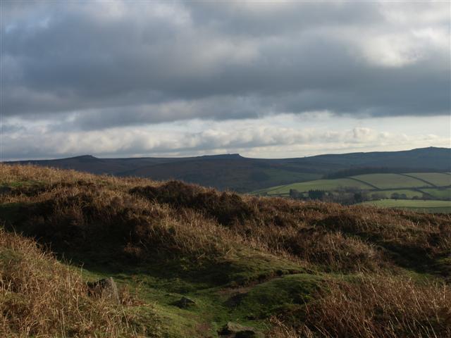
The Wheel stones on Derwent edge, just peeping over the horizon.

To our delight, we heard a Buzzard calling overhead, and watched as a pair cavorted and soared in the sky above us.

The reservoir was full to overflowing - literally! By the time we got back from our walk and took a stroll across the top of the dam, this overflow would have stopped. I was SURE I had seen it going over when we were up here, and it was only when I checked the photo that I saw I was right.

Time to pause and reflect on what was around us.

Sue, silhouetted against the cloudy sky.

The sharp top of Bamford edge.

The wind, frost and rain can create some weird effects.

Looking south along the edge.

The only blot on this fantastic landscape - Hope cement works.

The Ladybower dam, with Win Hill behind. The dam was strengthened in the 90's, you can read about it here; http://en.wikipedia.org/wiki/Ladybower_Reservoir

Old millstones left over and abandoned up on the edge.

Looking south to Froggatt and Cubar edges.
Bizarrely, we saw this mat at a stile - I know the fields are a bit muddy, but REALLY!!!!

We next had to cross the river Derwent by some stepping stones. No problem - there they are - just a little bit of water coming over them...........

Just hitch up the trouser bottoms, and we'd be ok, I reckon?

"Now just hang on", said Sue - "let me check the map. I'm NOT going over those no matter WHAT you say......"

We decided that it was a BIT too deep to go on, so we quickly re-wrote the walk and continued along the road. We then joined the bed of a disused railway that once served for the construction of the Ladybower dam. The view to our right of the edge we'd been on earlier was good. On a clear evening, the sunset lights this edge up flaming red. Sadly, tonight was not one of those nights.

Early signs of spring - the first catkins we've seen.

As I said, we walked across the dam for one last look over the reservoir in the dying rays of the day, then it was back home. This was the view over the water from the middle of the dam towards Derwent edge.


Don't forget - you can click on any of the photo's and get a slideshow of the pictures :-)
ReplyDeletelooks great, and good decision. Have a look at my blog if you get the chance www.artsy72.blogspot.com
ReplyDelete