Showing posts with label flora. Show all posts

Saturday, 24 November 2012

THE DERWENT VALLEY RESERVOIRS.

A WALK AROUND AND ABOVE 
THE DERWENT VALLEY RESERVOIRS.

We turned over from October to November on the calendar, and there was a lovely autumnal scene around Ladybower. Sue decided that was where she'd like to go for our next walk, so I wrote the walk, and off we went. This was our first walk in Derbyshire for about five weeks, due to holidays, work commitments etc, so we were raring to go!
I decided to park on the viaduct to jig the walk start round a little. I usually park further up the reservoir. This is looking up Ladybower.
 We crossed the road, and immediately took the path up towards Crookhill farm. I really was hoping to see some mushrooms today, edible if possible, as the conditions were damp, BUT I had heard that it wasn't a good year for fungi. 
 After the initial steepness, the path eased a little. Looking back, we could see Bamford edge looking larger. This is a SUPER edge if you want pictures of the reservoir.
The twin peaks of Crook hill could be seen to our left. 
Looking back to Crook hill's distinctive peaks. 

 After all the recent wet weather, the going underfoot wad decidedly squidgy!
 We topped the rise, and took the path that runs alongside the wood. This area used to have terrible damage from four wheel drive vehicles and motorbikes, but since they were excluded, the path has recovered a lot. The view left was of the iconic lose hill to Mam tor ridge, part of the Castleton skyline walk.
 This time of the year, you can always count on gorse to add a splash of colour to an otherwise drab scene.
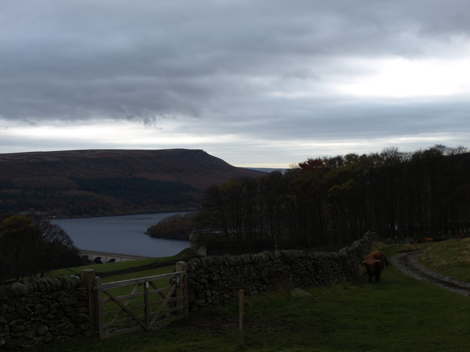
 We turned right to pass Lockerbrook farm and got our first glimpse of the reservoir since staring the walk. Normally, I would turn right, and go down through the woods to the Fairholme visitor centre, but that was the reason for parking in a different place - today we headed straight on, into the woods - a path I'd not walked before.
 One of my favourite photographic subjects - fungi. We'd not seen any of the edible variety, but this was a lovely bunch anyway.


 I also spotted this impressive, new bracket on a tree trunk.
 We were a week or two too late for the really splendid colours, but as the leaves had mostly fallen now, we had a warm, copper carpet to walk on.


 Just before we reached the valley and clearing, a Chinook helicopter flew by at ground level. One more minute, and I'd have got a video! We were now walking on level ground beside the Howden reservoir.
This trunk was suffering a full on attack by fungi, and it wouldn't be long before it crumbled down to earth. It looks like a grasping hand, reaching out of the ground,

Looking back to Howden dam, with water spilling over it.

 .....and forward to the Derwent dam towers
 The mighty Derwent dam. The water was rushing over Howden dam when we passed it, but it was barely trickling over the Derwent. The reservoir is brim-full, JUST.
 I usually only take photo's 'as is', but this one made a lovely subject for a sepia shot. It sort of gives the mood of this dreary, cold, damp time of they year.
 Something that we've only seen recently in the Peak District - hedge layering. Ingenious, the tall saplings are bent and chopped, and amazingly, they continue to grow, but horizontally! Less maintenance, and a thick cover for birds to nest in.
 We chose to cross to the 'quiet' side of Ladybower. It was a serene scene as we walked on the fallen leaves, the day all to ourselves.
 But, with the light fading, we reached the car. 
Looking up to Bamford, brooding over us as we left to go home. 
Our first walk for a while, and a really good day. Not bright, but dry, and for that, we were grateful.

Friday, 7 September 2012

Monsal Head, above Cressbrook dale, Millers Dale, Water cum Jolly dale


Another ‘local’ walk today, but hey - WHAT a locality to walk in! We parked up at Monsal head and dropped into the dale to cross the viaduct. We then walked across it, noting the lovely limestone buttresses on the opposite side of the valley. Sue & I have sat on top of these with a glass of wine to watch the sunset.

The track on the left after crossing the viaduct, signposted ‘Brushfield’, took us higher up and I got this great view of the houses and pub at Monsal Head as we looked back.

As the track topped out, we went right, near a dilapidated barn. Strictly speaking, there is no public footpath where we went (well, not for the first half mile or so), but as you can see, this land is not used for agriculture or grazing, so we have no compunction walking here. The ‘open access’ bill did open a lot of this land, but why this bit, with its fabulous views, was not included is beyond me This sort of view really shouldn’t be denied anyone, should it?

 A really good view of Cressbrook mill and the village. The mill is now apartments, mostly holiday lets, I am told.


The cliffs of Ravens Tor stand proud and sunlit above the dale. We’ve stood on top of these cliffs many times.

With there being no real path (except a rough sheep track) the going is quite hard on the ankles. Here’s Sue, making progress forward.

A lovely thistle, in the prime of flowering.

Cressbrook hall and village. The hall, although still a home, is now used for weddings and business meetings. You can see their website here; http://www.cressbrookhall.co.uk/

The super view down to Water-cum-Jolly dale. This walk goes through the dale later on. The Monsal trail tunnel is below us, at this point. It’s carved through that lump on the right.


You can see evidence of other, lower paths on the hillside. These are known as ‘alpine paths’, because of their similarity. Again, these were not permitted paths, but people came and walked here anyway before open access, just because it is just such a lovely place to walk.

The farmers are all gathering in the silage, hay etc as the week ahead was set to fair weather. We watched this one as he made patterns. We wondered just how he decided which was the best way to do it? It was already cut, he was just turning it.

As often happens, we saw a Kestrel on the hunt. It was just hanging in the stiff breeze, head stock still, scanning for a likely meal.

More field patterns near Priestcliffe, with the sun and shadows running across them.


These two sheep looked like they were trying to figure out the stile.

An overcast morning had turned into this – PERFECTION!

 It was THE perfect temperature for walking, and Sue and I were lapping it up. It was our first day off for two weeks, so we felt we deserved this wonderful day.

You can just see the spire of Tideswell church – the ‘cathedral of the Peak’, through the stile.

We were about to lose all the height we’d gained, and could see Millers dale and Chee dale ahead and below us.

I saw these lovely fungi. They were only tiny, but I always think fungi has a special beauty about it. Not gaudy and bright, like flowers, but understated and quiet. These were so delicate. Isn’t nature wonderful?


The site of an old quarry. Probably used to mine limestone for the kilns, or maybe for construction material for the Monsal trail railway? I’m not sure, but someone had placed a seat here, so Sue and I took full advantage to sit in the sunshine to eat our lunch. The seat looks outwards, to the right from this shot, so we spent a relaxed half hour eating and looking at the stunning view.

Then it was time to take the long drop into Millers dale. The ‘Anglers Rest’ pub is here, and I knew Sue would welcome a swift half and another short time with the sun on her. On the tops, there was a cool but welcome breeze. Outside the Anglers, it was still and hot. A regular little suntrap.

The wooden bridge, bathed in the sunshine of this wonderful day. The babble of the river below made it just PERFECT.


We saw many trout in the clear waters of the Wye. We noted that this was was ‘the one that got away’, as it still had what looked like a red lure in its mouth.

Sunbeams danced on the surface of the water as the trout lay in wait for passing meals.

How green is my valley?

After the pub, we decided to walk along the road. As it only leads to Litton mill, it’s really quiet. It was most enjoyable, with the river as company all the way. Eventually, the road ends and we walked through the old mill yard. Again, now apartments, many of them holiday lets.

Through the mill yard, the path turns into a ‘permitted path’, which runs through the incredibly beautiful Water-cum-Jolly dale. You can see Cressbrook hall again in the trees above and ahead. Swans and coots were swimming in the river. It was a really serene scene.


You can see how the limestone walls have been carved by millennia of water cutting into them. Now, the river is settled, but in past times, it would have been far more furious in its pace and volume.

Nearing the end of the dale. This is the mill pond for the old Cressbrook mill. The water was diverted down a ‘race’ to turn the huge wheels to power the mill machinery. You can read more about it here; http://www.peakdistrictinformation.com/towns/cressbrook.php

Now on ‘our side’, you can see the curvature of the walls where they have been worn away by the water. Because of these features, these walls are very popular with climbers. They come here to hone their techniques before moving on to higher stuff. This is like a climbers nursery, but some of the moves are VERY hard.

One was practising as we passed by. Oblivious to us, he studied and moved on the rock face.

Sitting ducks!

Looking back over the mill pond.

The weir that controlled the depth and flow.


Sitting like a grand tree house above us, Cressbrook hall peeped through the foliage as we left the dale and made our way back up to the Monsal trail. One last climb, and it was back home for tea.